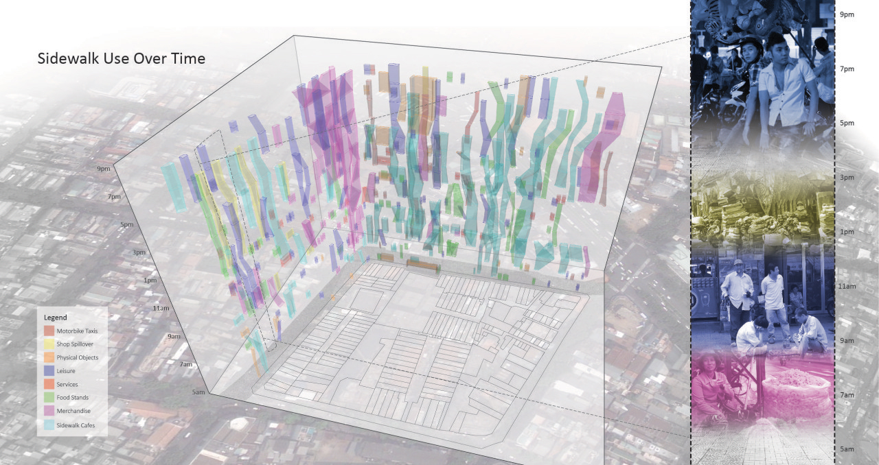
Space-time map
This map strategy integrates time on the z-axis in order to show how sidewalk uses and users change many times over the course of a day in Ho Chi Minh City. Abstract geometries of land use are re-coded into photographic images of people using urban space.